Reviews
Review: A Car-Free Day Out in the Peak District Using Buses and Trains
The Hope Valley line is the most useful piece of transport in the Peak District. Trains from Sheffield call at Grindleford, Hathersage, Bamford, Hope and Edale within about forty minutes, which puts you in the middle of the national park rather than at the edge of it. No car park to fight over, no designated driver, no scraping ice off the windscreen at dusk.
What follows is one full day out using that line, a walk over the ridge between Edale and Castleton, and a bus or train home. It works well. It also has a few sharp edges, mostly to do with timetables, that are worth knowing before you go.
Plan the day around the timetable, not the walk
The common mistake is to plan the walk first and the trains second. On the Hope Valley line, do it the other way round. The stopping service runs roughly once an hour in each direction, with longer gaps in the evening, so two or three departure times decide the shape of your day. Write them down before you leave the house.
Buy your ticket before you travel rather than at the station. Edale and Hope are unstaffed with limited facilities, so an app or the ticket machines at Sheffield are the sensible route. Sheffield has a staffed ticket hall, toilets and somewhere to buy a coffee, and the staff there are used to walkers asking about the last train back. If there are three or four of you, ask about group discounts at the ticket office; if you travel by train regularly, a Railcard usually pays for itself quickly.
The outbound run: Sheffield to Edale
The first twenty minutes are suburban and unremarkable. Then, somewhere past Dore, the view opens out and the country turns into the landscape people write books about. Grindleford comes first, with its café at the bottom of a memorably steep station approach. Then Hathersage, handy for Stanage Edge, the outdoor shops and Little John's grave; then Bamford, for Bamford Edge and the Ladybower reservoirs; then Hope.
Stay on to Edale for the full walk. The station is tiny: a platform, a shelter, a footbridge. The Penny Pot Café sits beside it, which makes a good start with a coffee and a bacon sandwich. The village is a fifteen-minute walk up the lane, and from there the path leads towards Barber Booth and the start of the Pennine Way.
The walk: Edale to Castleton, two ways
The valley route (easier)
From Edale village, follow the lane and field paths through Barber Booth and on towards Upper Booth. It is gentle, grassy and mostly flat, and it gives you a proper look at the valley without asking much of your legs. Good for a half day, mixed abilities, or a windy day when the tops are miserable. Turn back whenever you like and pick up the train at Edale.
The ridge route over Hollins Cross
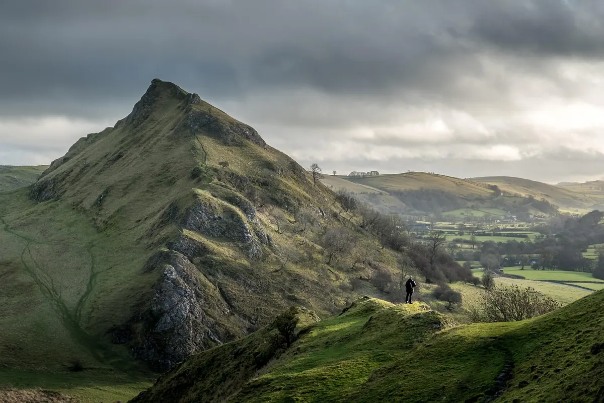
The better day, if you have the legs, is to climb to Hollins Cross and follow the Great Ridge. From Barber Booth the path lifts steadily to the pass, and the reward is the view back down into Edale on one side and across to Castleton on the other. From Hollins Cross you can drop straight into Castleton, or push west to Mam Tor first and descend from there.
Call it five or six miles with one proper climb. There is no shelter on the ridge and the wind up there is a different animal from the breeze in the valley, so take a waterproof and a warm layer even when the forecast looks kind. The descent from Hollins Cross turns greasy after rain and wet gritstone is genuinely slippery. Boots beat trainers by a wide margin here.
Facilities: toilets, food and somewhere out of the rain
- Edale: the Penny Pot Café at the station, a pub and a small village shop. No toilets at the station itself.
- Hope: a village shop and a couple of pubs a short walk from the platform, useful if you finish the walk here rather than at Castleton.
- Castleton: cafés, several pubs and the visitor centre, which has toilets, maps and staff who know the current bus times. If you have a connection to wait for, wait here.
- Hathersage and Grindleford: good cafés, and the station café at Grindleford is a local institution in its own right.
Buses, Bakewell and the wider network
For most walkers the bus matters in one specific way: getting between Hope, Castleton and the surrounding villages without trudging along the road. Local services run through the valley, and in summer there have been seasonal hop-on services aimed at visitors. These come and go, so check what is actually running in the year you travel.
Longer-distance buses are more settled. The 218 links Sheffield with Bakewell via Chatsworth, which is the practical way to do a house-and-garden day without a car, and the Transpeak service follows the A6 through Matlock, Bakewell and Buxton. Bakewell bus station is a genuine hub, with toilets and shops a minute away, and it is a far better place to be stranded than a lay-by on the moors.
The rule with buses is simple: route numbers, frequencies and seasonal services change more often than train timetables do. Check the operator's current timetable in the week you go, and check the last bus home as carefully as the last train.
Where it can go wrong
- The last train back to Sheffield is earlier than you would like, particularly in winter, and the gaps between services can be an hour or more. Missing one train is an inconvenience; missing the last one is a problem.
- Mobile signal is patchy in the valleys and worse on the tops. Download timetables, tickets and an offline map before you set out.
- Sunday and bank holiday services differ, and some bus routes only run on summer weekends.
- Edale, Hope and Bamford stations are unstaffed, with no toilets and little in the way of a waiting room.
- The weather on the ridge can be nothing like the weather in Hope. Cloud drops fast on Kinder and the Great Ridge.
- Castleton and Edale pubs fill up on sunny Saturdays. If a group of you wants a table, ring ahead.
- Taxis in the Hope Valley are few. Have a fallback plan, even if it is a long sit in a warm pub.
The verdict
Car-free works here, and in some ways it works better. Edale's car parks fill early on a fine weekend, while the train drops you at the trailhead. You can have a pint at the end of the walk without doing mental arithmetic about driving. The trade is flexibility: you are running to someone else's clock, and that clock is not generous after about six in the evening.
Do it with a plan, two or three train times written down, a paper map, boots and a waterproof, and it is one of the most satisfying days out in the Peak District. Turn up without checking anything and you will spend the last of the daylight on a platform wondering whether that really was the last train.
Practical essentials
A short checklist before you set off:
- Check the current Hope Valley line timetable and, if you are using buses, the operator's own timetable or a journey planner such as Traveline.
- Buy tickets in advance and note the last direct service home, plus the last connection if you are travelling beyond Sheffield.
- Carry a paper map (Ordnance Survey Explorer OL1 covers the Dark Peak), a headtorch, water and food. There are no shops between Edale and Castleton.
- Wear boots with real grip and pack a waterproof. The ridge is exposed and the weather changes quickly.
- Tell someone your route and expected return time, especially if you are heading onto Kinder Scout.
- Mountain rescue teams in the Peak District are volunteers, and they are there for emergencies rather than for tired legs. If you have a medical condition or are unsure whether a long hill day suits you, speak to a GP or another qualified professional first.
Photo: TimHill / Pixabay
Related Articles